Since 2012, Crestmont Land Trust (“CLT”) has implemented many initiatives to enhance the ecological integrity and general habitat of the property to benefit native vegetation and wildlife species.
Shortly after purchasing the property and assuming its stewardship, CLT began the process of evaluating conditions and developing a management plan. CLT contracted with a biologist that had recently retired from the U.S. Fish and Wildlife Service to conduct extensive surveys and prepare detailed recommendations for ecological and wildlife enhancements. The evaluation and plan were completed in 2013.
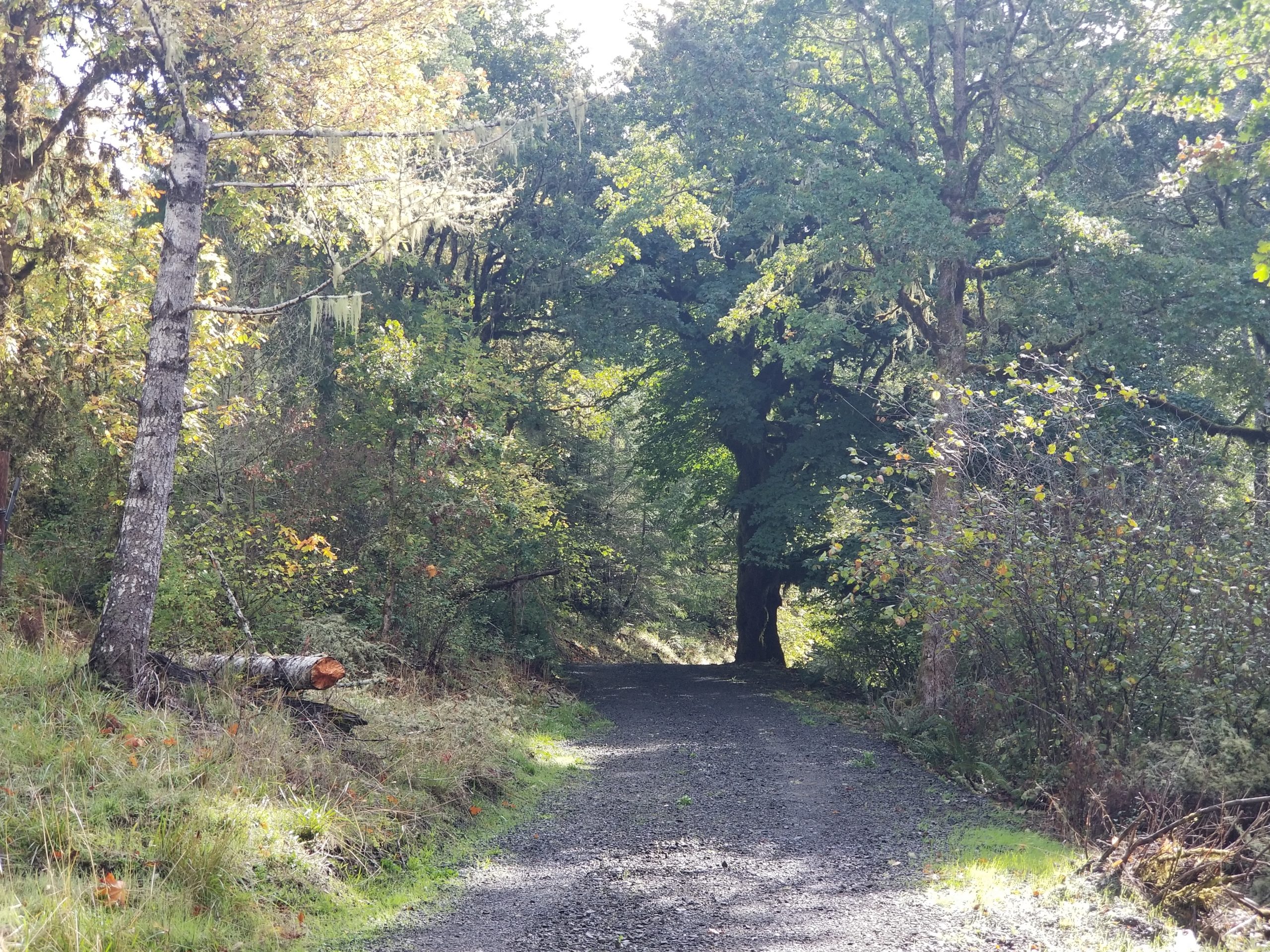

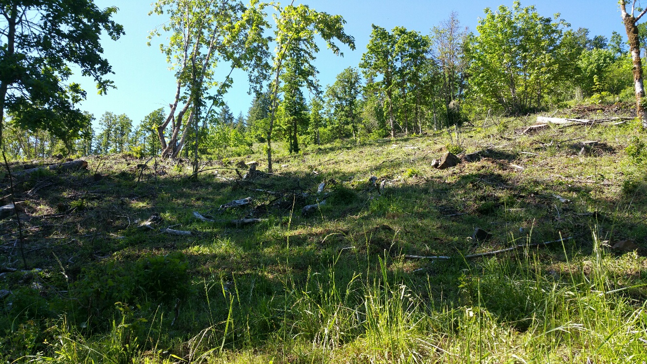
During 2013 and 2014, to facilitate management access throughout the property, CLT improved the property’s spur roads for enhanced all-weather access and began the development of utility and recreation access trails.
The primary access trail into the area is a segment of Cardwell Hill Road. It is owned by Benton County and was closed to public vehicles several decades ago. Over the years, the condition of the road deteriorated. As the community began to use the road as a trail, Crestmont Land Trust collaborated with Benton County in 2014 to provide over 1,000 tons of crushed rock, drainage culvert, and equipment services to help the County restore the road. The work included the full segment of the Cardwell Hill Trail from the Corvallis-side parking kiosk to the Wren-side parking kiosk.
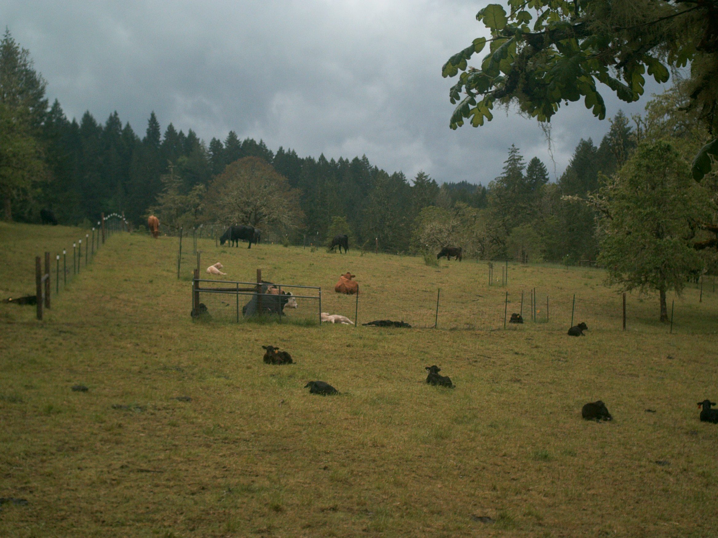
Further, to enable the use of cattle for habitat grazing, a fence was installed on the perimeter of the property and along the public Cardwell Hill Trail. Cattle strategically graze the open spaces a few times per year to improve and maintain habitat conditions around the property.
A fenced area was also installed in the meadow adjacent to the Marys River to protect native planting scalps that include Kincaid’s Lupine, the threatened host plant for the endangered Fender’s Blue butterfly. An informal grazing study continues in this area, with the objective of assessing the impact of cattle grazing on Kincaid’s Lupine and Fender’s Blue butterfly habitat. CLT has a formal Safe Harbor agreement with the U.S. Fish and Wildlife Service to encourage actions benefiting Fender’s Blue butterfly habitat.
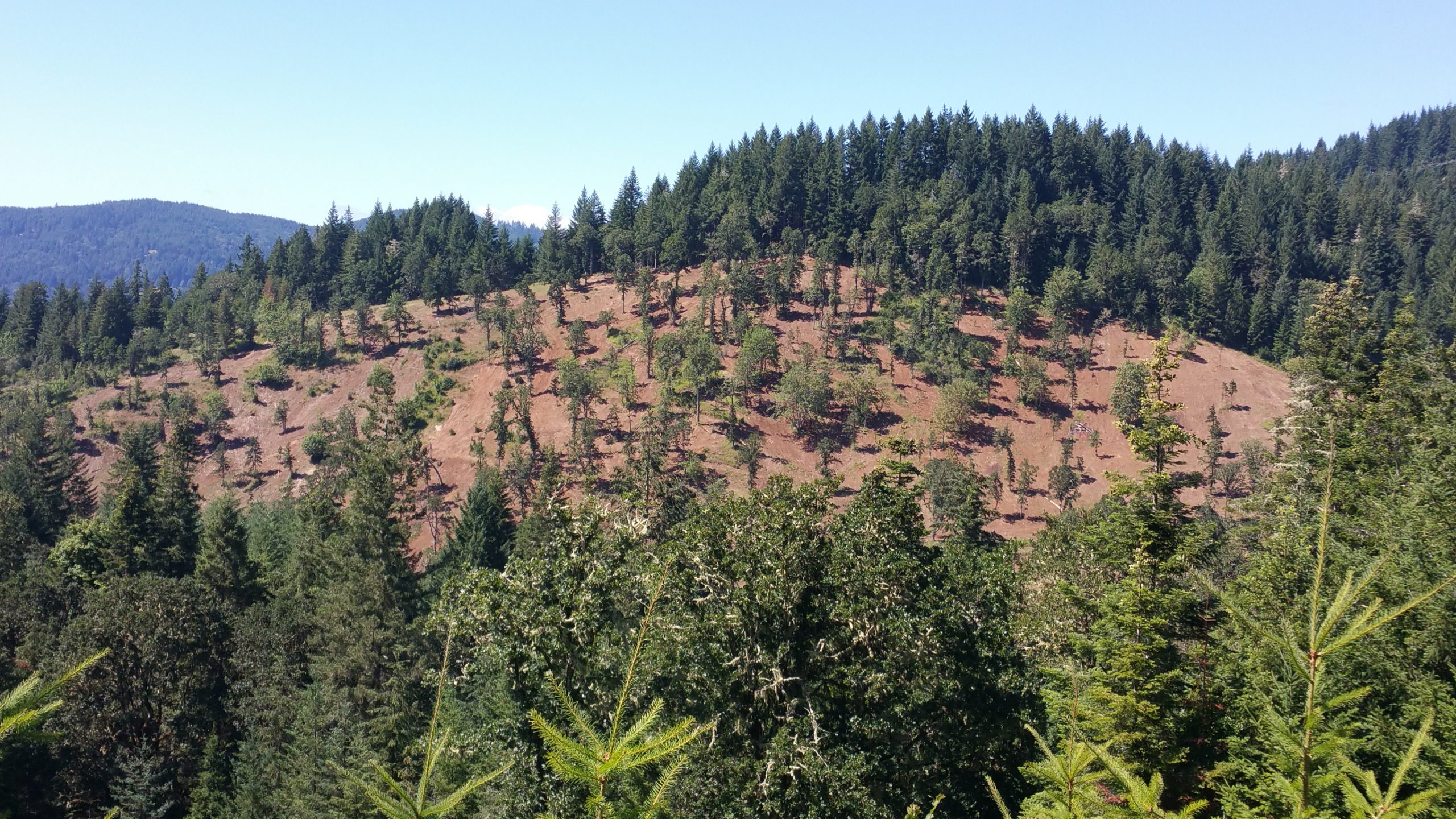
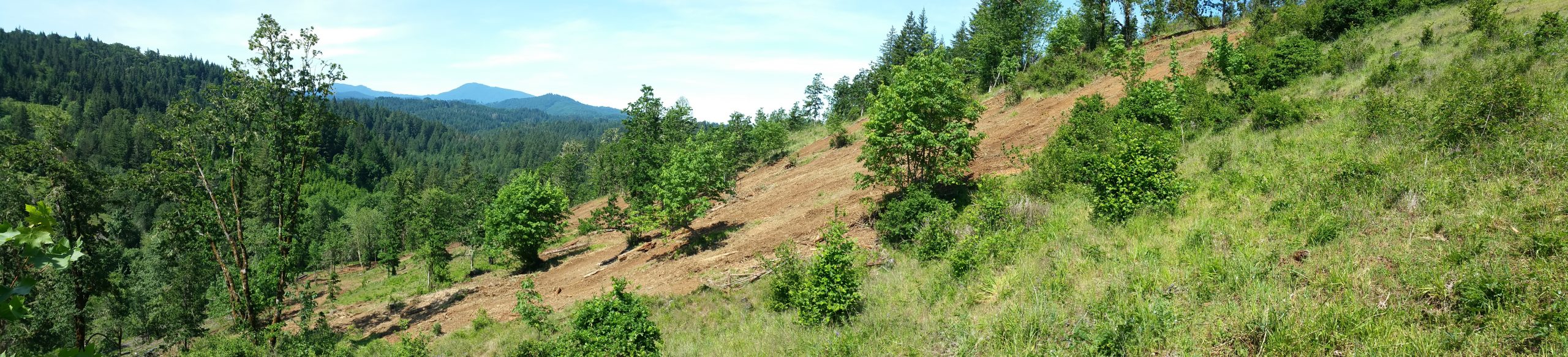
During 2015, CLT began a multi-year process to selectively diversify the range of habitats on the property. The initial work started on 42.2 acres adjacent to the Cardwell Hill Trail. Tree density was thinned, and invasive vegetation was removed to create oak savanna and oak woodland conditions.
In 2018, 51.4 acres were selectively thinned to promote oak woodland and oak-fir woodland conditions. The objectives included enhancing the survival and growth of native white oaks and associated species, promoting woodland and forest health, reducing fire risk, and enhancing understory and midstory conditions.
In 2018 and 2019, 10.6 acres of mature production timber was delimbed and thinned to improve the quality and growth of the remaining timber, while another 8.4 acres of young plantation Douglas fir was thinned to remove excess natural regeneration that would ultimately compromise the productivity and health of the stand.
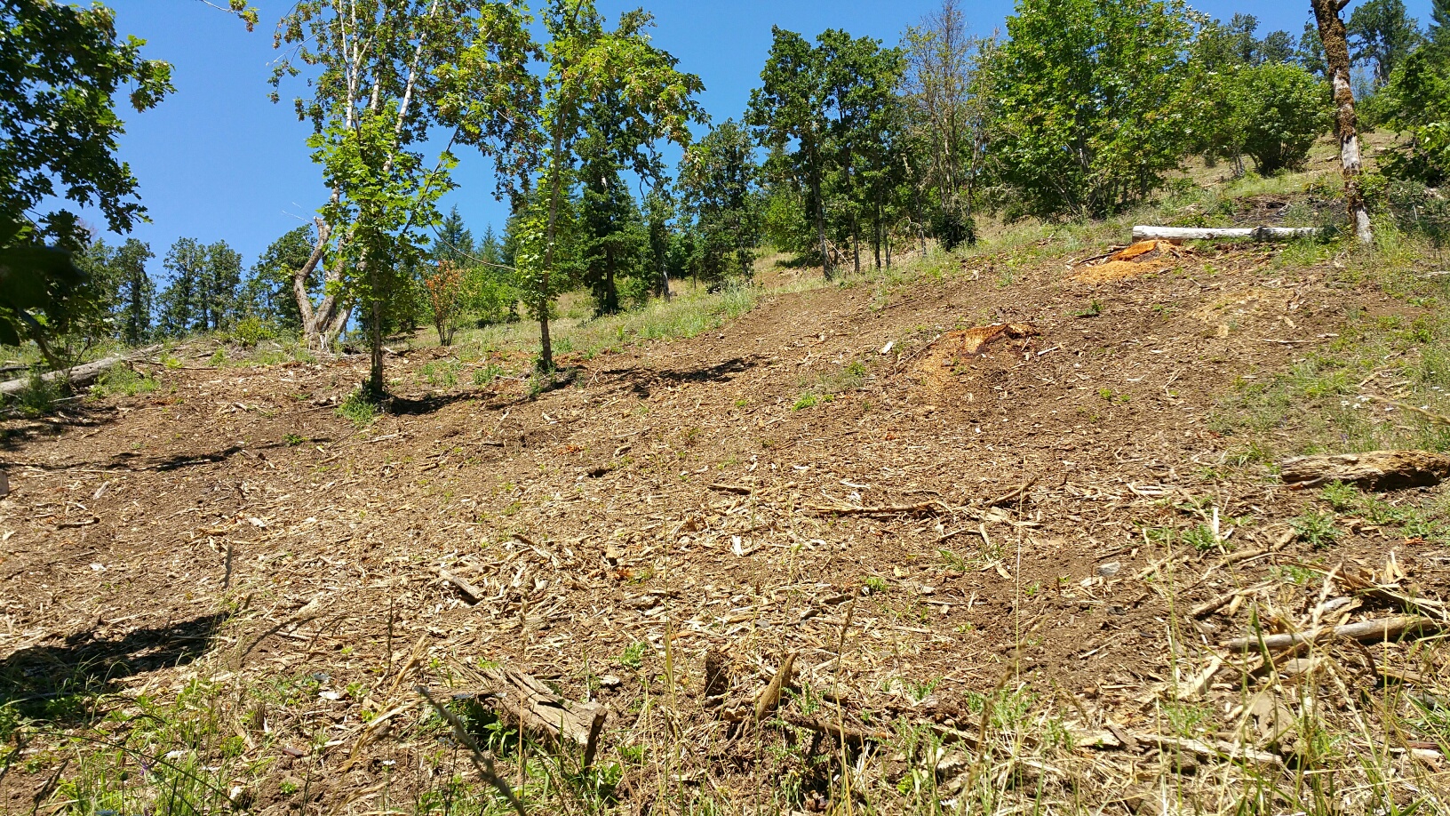
Following the 2015-2019 operations, residual slash and excess debris were treated by mulching, piling and burning, or lopping and scattering. Most stumps were removed to improve management and fire-fighting access, to accelerate stump biomass decomposition and nutrient cycling, and to promote a more natural aesthetic.
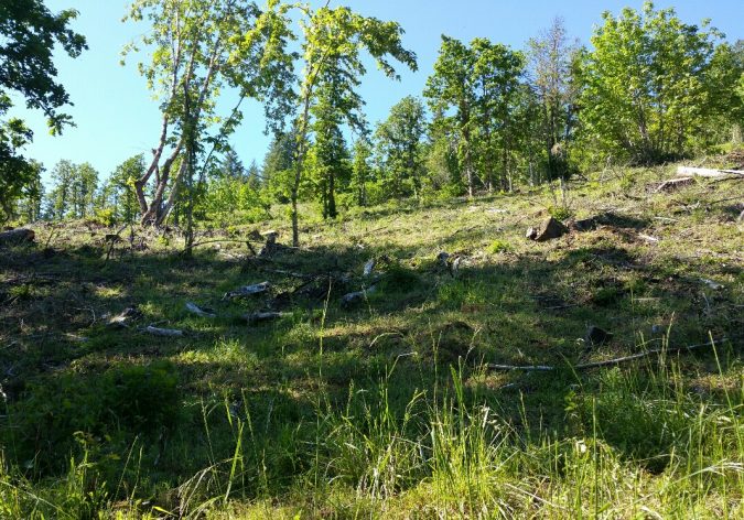
Before stump removal and mulching 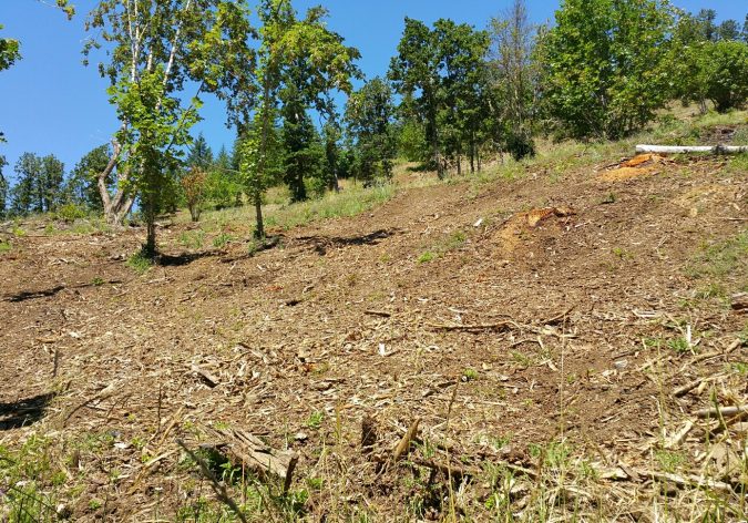
After stump removal and mulching 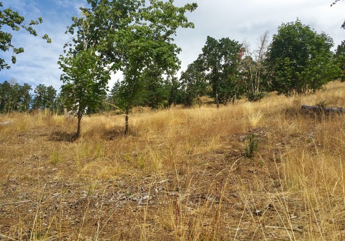
After seeding
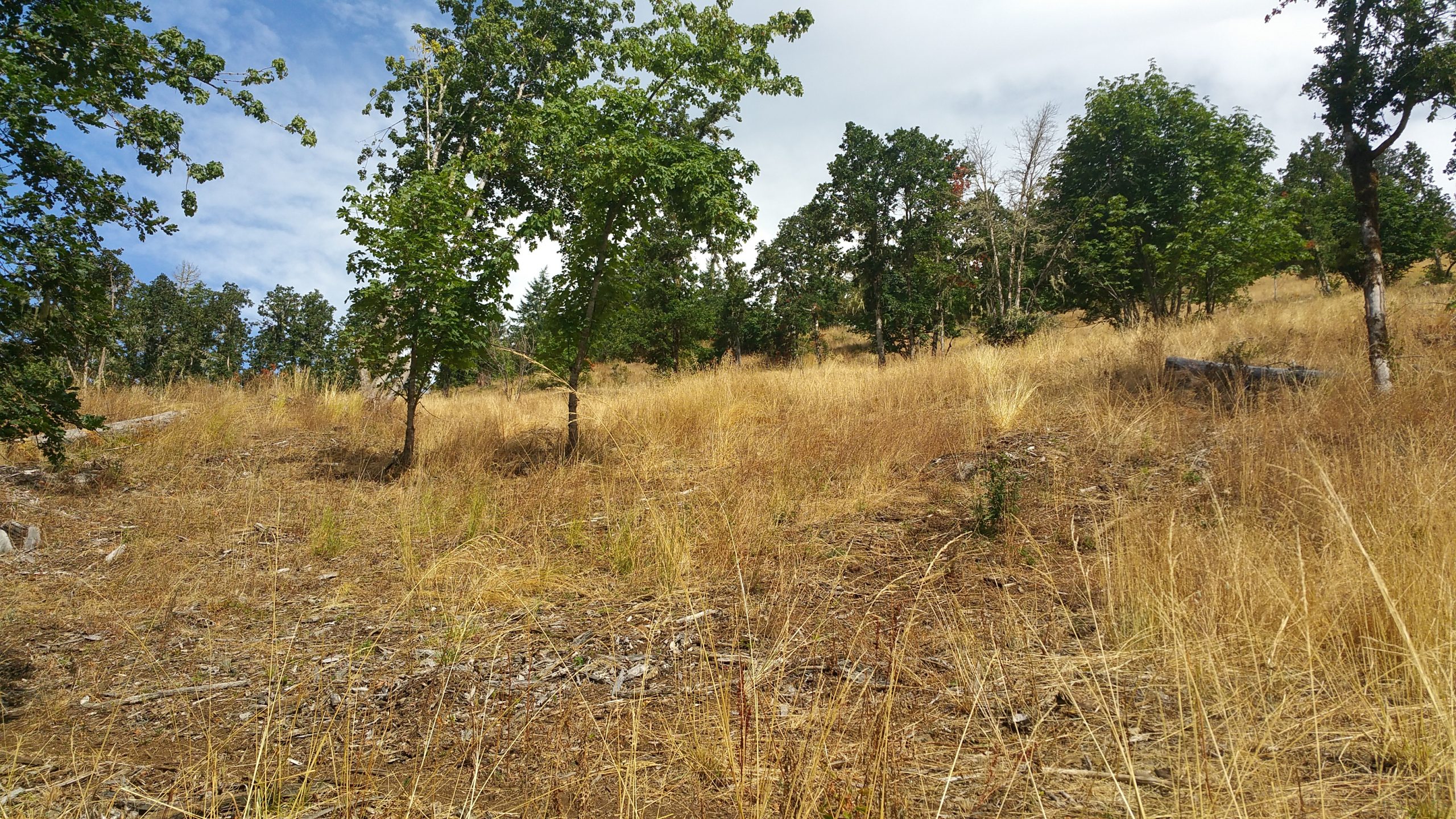
Invasive weed and brush species have been treated most years by mechanical, chemical, and grazing protocols. Additionally, native grass and forb seeds have been planted in many areas. In 2020, 811 native trees and shrubs were planted to facilitate the growth of a multilayer structure, to promote the reestablishment of a native ecosystem, and to create suitable habitats for the full range of all respective organisms.
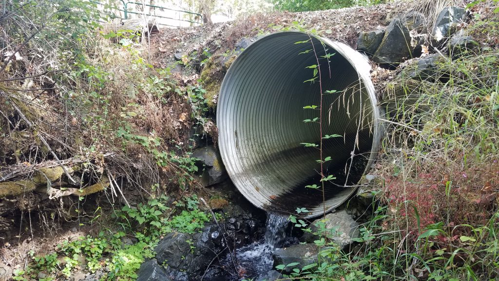
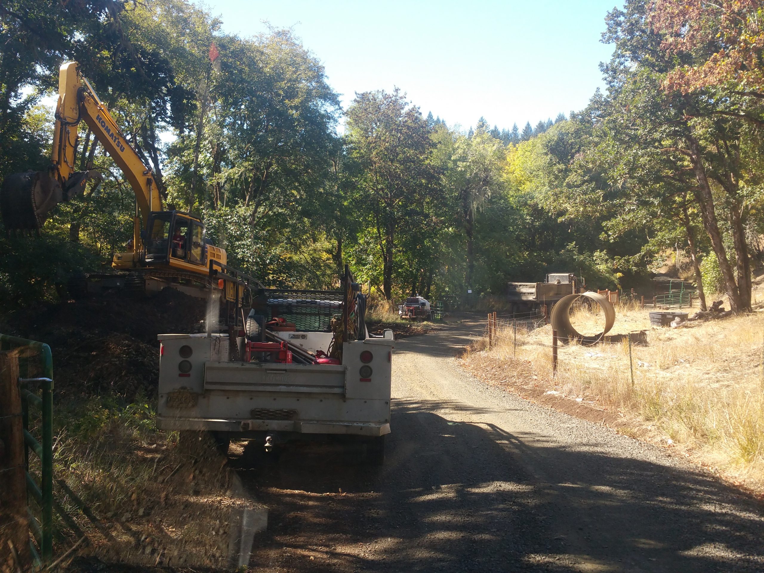
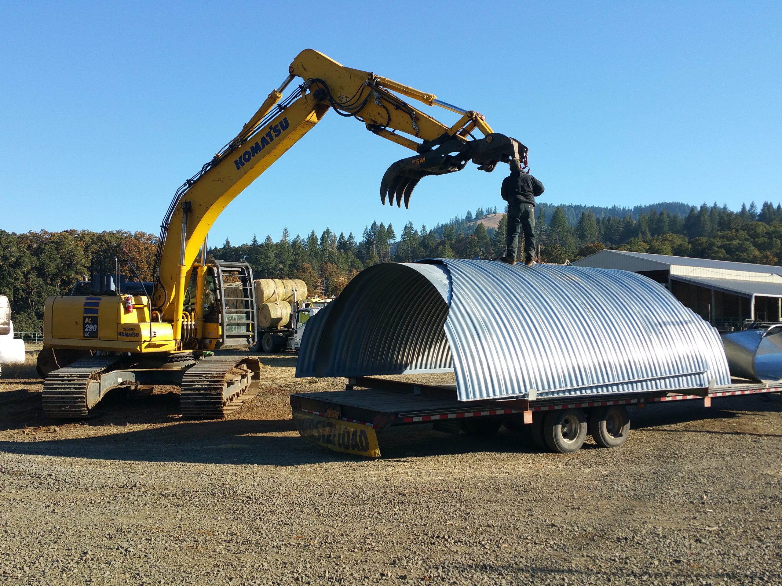
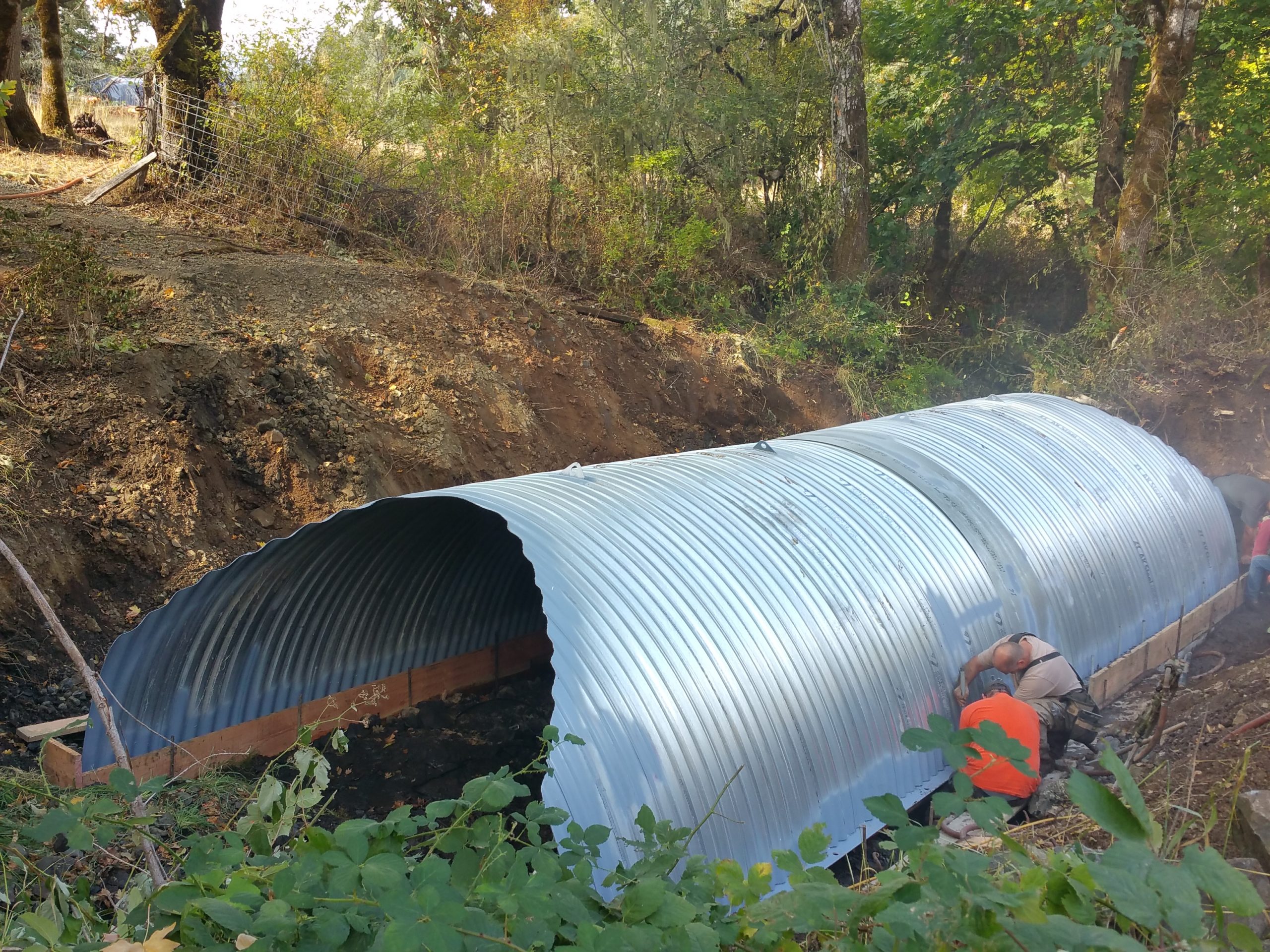
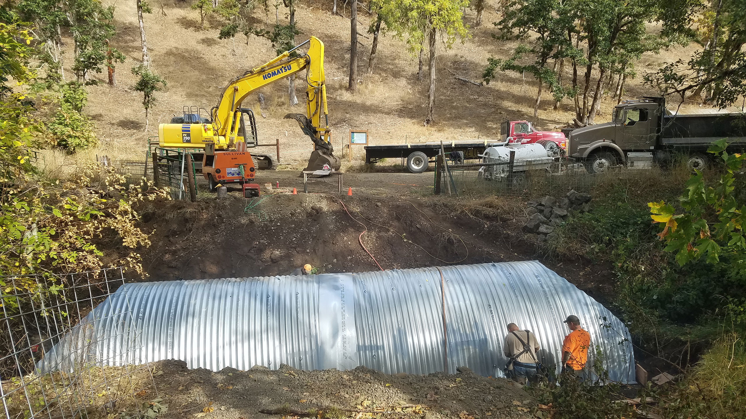
In 2018, with the support of Oregon Watershed Enhancement Board, CLT replaced a significant culvert at the primary entrance to the south side of the property from the Cardwell Hill Trail. The previous culvert was perched above the streambed, which inhibited fish passage. The new bottomless arched culvert provides full natural streambed conditions to promote important fish passage and other aquatic usage of the tributary. Another compromised culvert on the property, which posed a risk to creek structure integrity and water quality upstream, was improved as well.

Crestmont Land Trust has collaborated extensively with a host of resource partners and community organizations. They include, but are not limited to, the Natural Resources Conservation Service, U.S. Fish and Wildlife Service, Oregon Watershed Enhancement Board, Marys River Watershed Council, Benton Soil and Water Conservation District, Audubon Society, and Oregon Department of Forestry.